Mobile LiDAR Acquisition and Feature Extraction
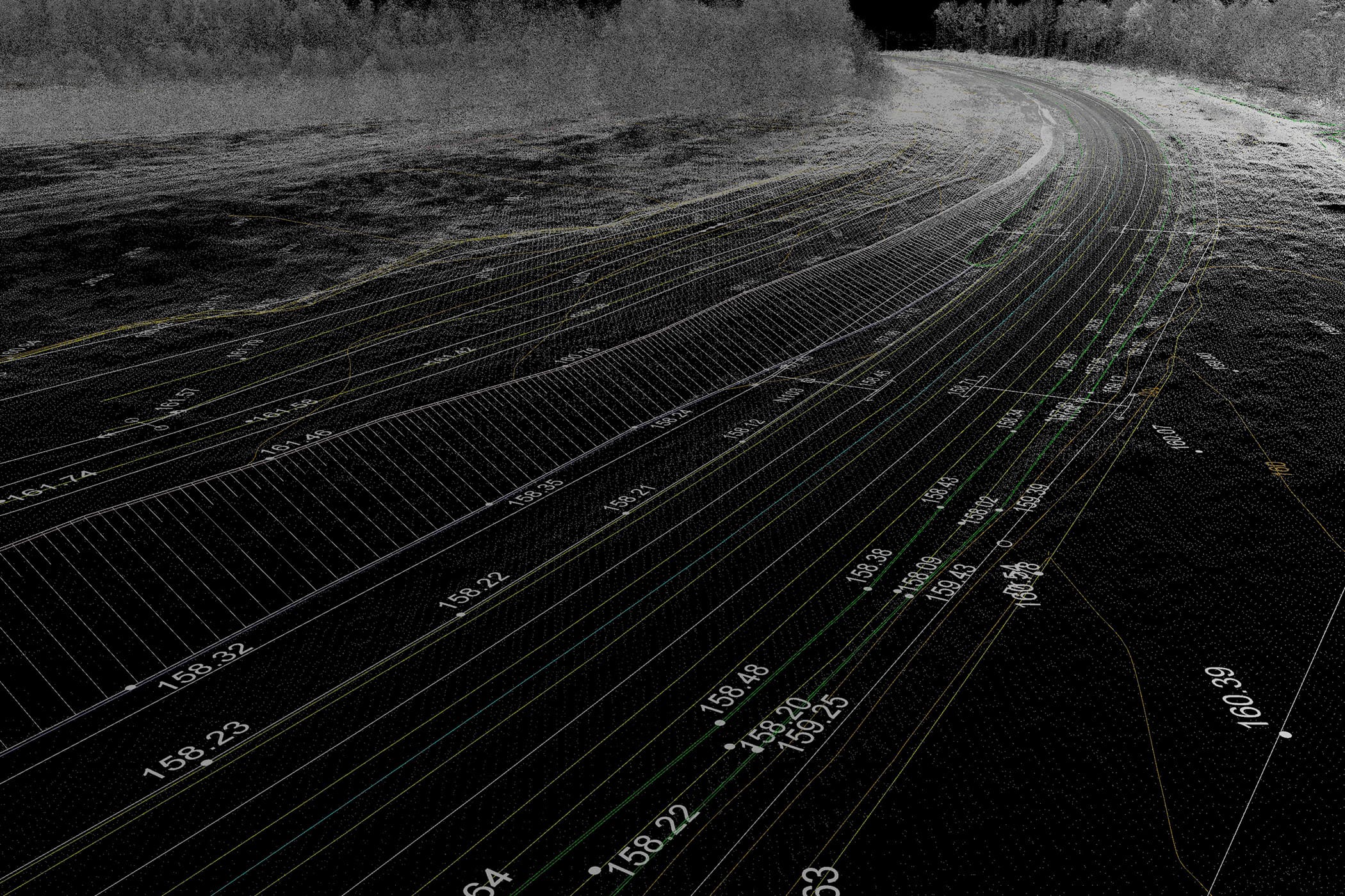
Obtain survey-grade LiDAR point clouds and high-resolution imagery with Rizing’s mobile mapping services. Rizing offers comprehensive and accurate mobile LiDAR data acquisition, processing, and feature extraction services for traditional survey and asset inventory projects. Our state-of-the-art mobile mapping technology includes the Leica Pegasus: Two Ultimate to capture high-resolution point clouds and 360-degree, georeferenced color spherical imagery.
Collect data once, use over and over
Feature extraction improvements provide greater automation and higher feature detection hit rates. That makes it faster and easier to generate comprehensive, attributed geospatial and design data. Use extracted data for asset inventories or survey and engineering applications to bridge the gap between engineering and planning divisions.
Planning
Today’s transportation agencies are highly focused on asset management but often, asset inventories do not exist or are incomplete or out of date. Mobile mapping allows agencies to quickly produce accurate, thorough asset inventories.
Engineering
Data collected for asset inventories can serve as the foundation of engineering and survey projects. Make your collected data more valuable and provide more accurate design qualities by adding control.
GIS
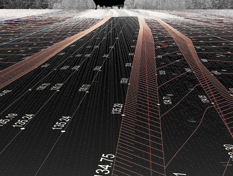
Use asset data output from collected point clouds and imagery with Rizing’s geospatial products, including Road Analyzer. Road Analyzer visualizes data in straight-line format and can combine LiDAR-collected data with features and events that transportation planning departments traditionally maintain.
Service benefits
- Highly accurate point clouds with integrated 360-degree image capture at prevailing highway speeds
- Routine collection of up to 60 miles each day; video logs and point clouds processed within 24 hours
- Extracted features and legacy geospatial databases displayed in the same environment
- Synchronized point clouds and video log display alongside extracted assets in Rizing’s Road Analyzer
- Industry-leading feature extraction software increases the speed and ease of asset and attribute production
- Integration with asset management (AM) products allowing extracted data to be loaded into both GIS and AM environments
Rizing uses the survey-grade Leica Pegasus: Two Ultimate system, Leica’s newest system with dual scanner heads and a 360° camera. We can leverage our base stations if sub-centimeter accuracy is desired and offer comprehensive and accurate mobile LiDAR data acquisition.
The data we collect can be used for asset inventories and engineering applications, netting greater benefits and a higher ROI than traditional LiDAR and video log vendors. Because of this, Rizing’s mobile mapping deliverables bridge the gap between engineering and planning divisions within transportation agencies. Collected data can be used multiple times for many purposes.
LiDAR capabilities
- Without control, we routinely achieve 10 cm absolute accuracy, with control, we routinely achieve 3 cm accuracy
- Relative accuracy is a few millimeters
- Mobile LiDAR costs vary from $100/mile for mapping grade “fuzzy” LiDAR systems to $10,000+/mile for complex survey or design projects; most of our projects are in the $600-$1,000/mile without control (asset inventory) and $1,000 – $10,000/mile (estimate) for controlled design projects
Typical LiDAR projects
- Rail for asset inventory with high degree of accuracy for PTC
- Telecom for asset inventory with a lower degree of accuracy
- DOTs a sub to an engineering firm – collect and process only or collect, process with control, extract
- DOTs and other government agencies (cities, airports) as a sub to a pavement condition collector
- Deliverables are typically CAD (MicroStation or Autodesk) and/or GIS shapefiles/geodatabases